OIAPL provides a comprehensive reverse engineering service. Our 3D scanning technology will capture 3D measurements as small as a flange bolt dia or as large as a Process plant. 3D Laser Scanning is a non-contact, non-destructive technology that digitally measure fine details and capture free-form shapes to quickly generate highly accurate point clouds. The scope of applications becomes virtually limitless with 3D digital data in hand. While much of our work is in reverse engineering and product inspection, there are so many other uses for our 3D laser scanning and 3D measurement data. Our team of highly skilled professionals can transform the raw point cloud or CMM data into output formats that are the foundation for design, documentation, visualization, and analysis as well.
At OIAPL, we have a highly experienced staff capable of effectively converting the point cloud data to 3D models and CAD depending on the customer's requirements. It involves 3D modelling conversion with the necessary gear and software to assist owners and operators in mitigating risk and meeting project criteria.
Point cloud processing is available at two different levels for conversions to the 3D model:
With specialized know-how, our team conducts unique technical investigations with licensed engineers for industrial reverse engineering of point cloud data into current CAD software and tackles mission-critical engineering tasks in record time.
Workflow for Point Cloud to CAD Modelling Services:
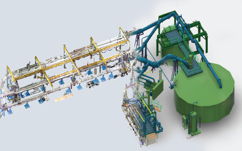
However, the resulting scanned files are in point format, which has no practical application. Our service offering, therefore, includes the conversion of point cloud data to 3D model formats based on customer requirements. The resulting 3D model file includes topography, buildings, structural, piping, equipment, packages, and more, in a precise manner, as per the received scanned data.
Ori-Occi Industrial Associates Private Limited (OIA) established in 2013 provides Piping Engineering consultancy services to a wide range of industries comprising of Oil and Gas (Onshore & Offshore), Petroleum Refineries, Petrochemicals, Chemicals, Pharmaceuticals, Water treatment etc. in the global market. At OIA, we provide solutions to our customers in both green-field and brown-field projects.
© 2022 Ori-Occi Industrial Associates Private Limited - All Rights Reserved